Managing public access: lessons from Salisbury Plain
Drawing on lessons from the Imber Range Perimeter Path, CLA National Access Adviser Claire Wright explains how effective signage and clear boundaries can help landowners manage access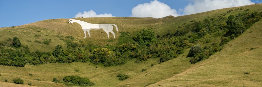
Last month I was fortunate enough to join an organised ride on an 18-mile section of the Imber Range Perimeter Path (IRPP), crossing some of the most distinctive landscapes on Salisbury Plain.
The IRPP is a 30-mile circular permissive route around the edge of the Imber Ranges. Designed as a multi-user trail for walkers, cyclists and horse riders, it is clearly marked with distinctive signage for the Imber Range Path and is generally available throughout the year, although temporary closures may be required when military training is taking place.
The route officially opened in 2016 following lengthy negotiations about how best to balance public access to this remarkable landscape with the military's need to undertake live-fire training. That balance has long been a contentious issue for the local area.
At the heart of on Salisbury Plain lies the village of Imber, which was evacuated in 1943 to allow troop training ahead of D-Day. Villagers were given just 47 days to leave their homes and possessions behind. Although they expected to return after the war, the land was retained by the Ministry of Defence and became part of the military training estate. Imber was never reoccupied and remains one of England's most famous "lost villages".
Today, the IRPP allows visitors to experience much of the area's unique character while respecting the operational requirements of the military estate. The route takes in iconic Wiltshire landmarks, including the Westbury White Horse and a number of Iron Age hill forts, while also providing views of more modern military infrastructure such as the urban warfare training village at Copehill Down. It is a striking landscape where centuries of history sit alongside contemporary military activity.
Direct public access to the Imber live-firing area and impact zone is permanently prohibited under the Imber Ranges Byelaws 1963 for obvious safety reasons. As a result, the IRPP provides an important recreational resource, allowing people to enjoy the area without entering land where access cannot safely be accommodated. In many places, the path runs close to the edge of the active training area, providing a reminder of the careful balance that must be maintained between public enjoyment and military necessity.
Managing that balance is not without its challenges. Between September 2024 and September 2025, the army recorded approximately 1,100 incursions onto restricted parts of the training estate. These incidents range from people ignoring warning signs to individuals entering areas marked by red flags or lamps indicating that live firing is taking place. To address this, the Ministry of Defence has launched a "Respect the Range" campaign aimed at educating visitors about the risks and encouraging responsible behaviour.
‘Clear and consistent signage’ - the lessons for land managers
As I rode the route, I found myself reflecting on the lessons it offers for land managers facing difficult access issues. Although the Imber Ranges represent an extreme example, the principles are widely applicable.
Well-designed permissive access can be an effective tool for managing public use, particularly where unrestricted access is incompatible with other land uses
By providing attractive, clearly defined routes that deliver a positive visitor experience, land managers can encourage people towards areas where access can be safely accommodated and away from those where it cannot.
The route also demonstrates the importance of clear and consistent signage. Throughout the IRPP, users are given confidence that they are following the correct route, while separate advisory signs clearly explain where access restrictions apply and why they are necessary. Together, these measures reduce confusion and help secure public cooperation.
Successful access management is rarely a simple choice between allowing access and preventing it. More often, it is about providing safe, attractive and understandable opportunities for people to experience the countryside while protecting other legitimate land uses
The Imber Range Perimeter Path is an excellent example of how thoughtful route design, clear communication and effective partnership working can achieve that balance, even in one of the most sensitive and heavily managed landscapes in the country.
